
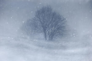
BOONE, Iowa—The National Weather Service has issued the second Winter Storm Warning affecting Central Iowa this week. While clean-up for the first multi-inch snowfall has been ongoing, the second event begins Thursday and will continue Friday. The second storm will be followed by bitter cold and dangerous windchills.
URGENT - WINTER WEATHER MESSAGE
National Weather Service Des Moines IA
328 AM CST Thu Jan 11 2024

...Accumulating Snowfall with Gusty Winds Tonight Through
Friday...

.A multi-faceted winter storm will pass through the state
starting tonight and lasting through Friday. Snowfall amounts
from 5 to 10 inches are expected over much of central Iowa along
with winds gusting over 40 mph Friday afternoon into early
Saturday. The combination of gusty winds, snow on the ground from
the previous winter storm, and new, fluffy snow falling tonight
into Friday will lead to a significant blowing snow threat on
Friday into Saturday. The blowing and drifting snow may lead to
near-whiteout conditions, especially in open and rural areas with
the hazardous conditions continuing well beyond the end of the
falling snow. Therefore, hazardous travel conditions are expected
through much of the state on Friday, including both the morning
and evening commutes, with impacts extending into at least early
Saturday. Temperatures will also fall to the single digits above
or below zero by early Saturday with wind chills near to well
below zero by Friday night, adding an extra layer of risk to
travel on Friday.

...WINTER STORM WARNING IN EFFECT FROM 9 PM THIS EVENING TO
MIDNIGHT CST FRIDAY NIGHT...

* WHAT...Heavy snow expected. Total snow accumulations of 5 to 10
  inches. Ice accumulations of up to a light glaze in southeast
  Iowa. Wind gusts over 40 mph causing significant blowing and
  drifting snow and near-blizzard conditions extending beyond the
  end of falling snow.

* WHERE...All of Central Iowa.

* WHEN...From 9 PM this evening to midnight CST Friday night.

* IMPACTS...Travel could be very difficult. Blowing snow could
  significantly reduce visibility to near-whiteout conditions
  later Friday into Saturday. The hazardous conditions will greatly
  impact the morning and evening commutes Friday. The cold wind
  chills as low as 10 to 20 below zero could cause frostbite on
  exposed skin in as little as 30 minutes.

PRECAUTIONARY/PREPAREDNESS ACTIONS...

If you must travel, keep an extra flashlight, food, and water in
your vehicle in case of an emergency.

For the latest travel conditions, check the Iowa 511 app,
www.511ia.org, or dial 511.
(contributed information, NWS)